Prachtsatlanten – a Citizen Science Project
In 2023, the Map Collection of the Zurich Central Library (ZB) successfully carried out the citizen science project “Prachtsatlanten.”
For this project, over 2,900 old maps were selected from the oldest and most beautiful Prachtsatlanten collections dating from the 15th to the 17th centuries and digitized.
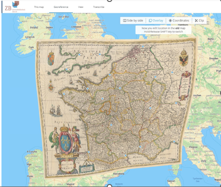
Citizen scientists were then invited to georeference the maps contained therein. In just one month, volunteers georeferenced the 2,919 maps by identifying matching points on modern and historical maps.
The project’s completion was celebrated on March 18, 2023, with a public workshop.
The individual maps and their associated metadata are available for research by anyone interested on the Old Maps Online website.
On the e-rara platform, the public can browse the digitized collection Prachtsatlanten: From the Beginnings to the Golden Age.
Figure: Setting reference points in the “Georeferencer” tool (Le Royaume de France, from: Blaeu Atlas 1641/1642)