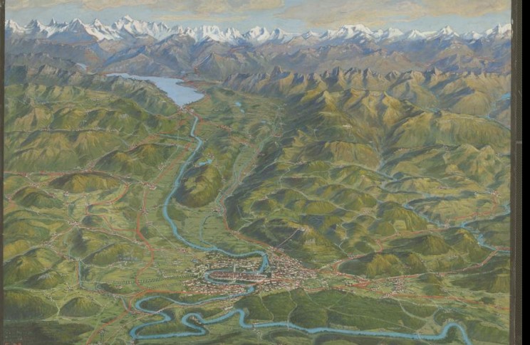
Giovanni Maggini – Pioneer of Bird’s-Eye-View Cartography in Switzerland
Giovanni Maggini created maps that were always as accurate as necessary and as beautiful as possible—as described by Thomas Bachmann, who presented the first in-depth study on Maggini at the International Atlas Days.
Maggini was a learned engineer and cartographer in the cartographic department of Orell Füssli. He devoted himself to a genre that received little attention at the time: bird’s-eye-view maps—representations that are better understood as landscape paintings than as topographic maps. In 1891, a map by Maggini was published announcing a “People’s Atlas of Switzerland in 28 Bird’s-Eye View Sheets.”
By 1906, 24 sheets of this atlas had been published at irregular intervals. The maps feature widely varying scales and fluid transitions between the sheets—an indication that they were conceived as individual pieces rather than as a cohesive whole.
In 1909, Maggini left the publishing house without completing the atlas. The reason for this is unknown. In the years that followed, he continued to work independently, specializing in bird’s-eye-view maps and later also drawing maps of theaters of war. His last map—an aerial map of Graubünden—was published in 1925; Maggini died a year later.
We are pleased that the Maggini collection from Thomas Bachmann’s holdings is now housed at the Zurich Central Library. It will be cataloged there and made available to the public on a long-term basis.
Image: Maggini, Giovanni: [Bern, Aare Valley, and the Bernese Alps]. [191-]-[192-]. Zurich Central Library, MK 1160