Topographic Map Series of Cameroon
In the spring of 2023, the Maps and Panoramas Department of the Zurich Central Library was able to acquire the latest edition of the new large-scale topographic maps for the Central African country of the Republic of Cameroon, which were available for the first time (on the market/in map stores).
The topographic maps originally available (1:500,000 / 1:200,000 / urban areas at 1: 50,000) for Cameroon were produced under French mandate by the French government agency, the IGN in Paris, in conjunction with other map series for Central African countries from the 1960s through the 1980s. These map series are outdated, largely out of print, and no longer officially available.
In 2017, the INC (Institut National de Cartographie) in Yaoundé independently began producing new digitally created national topographic map series at scales of 1: 25,000, and, starting in 2020, a new national series at a scale of 1:50,000.
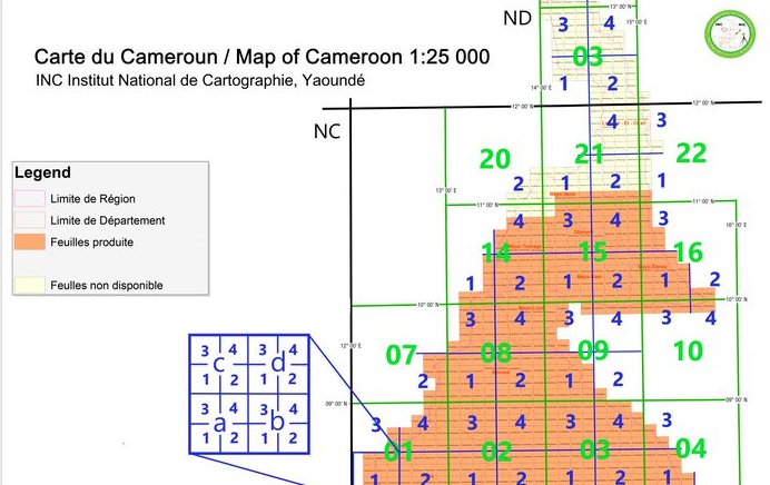
The two new series acquired by the ZBZ—at scales of 1:50,000 (approximately 70 sheets to date) and 1: 25,000 (currently approx. 261 sheets) are still under development and, provided that work continues uninterrupted and funding is secured, will be published in full for the entire country over the next few years.
Mapping Cameroon is complicated by ongoing political unrest in parts of the country, which has resulted, among other things, in “blank spots”—uncharted areas—on the maps of the new 1:25,000 topographic series.