Matterhorn
Did you know that during the first ascent of the Matterhorn, Whymper and his climbing partners were four meters closer to the sky than today’s mountaineers—if one considers only the elevation contours?
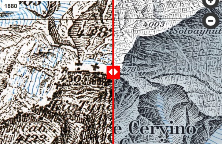
During the first ascent of the Matterhorn 150 years ago, the mountain’s height was listed as 4’482m on the most accurate topographic map of the time, the Dufour Map.
On the current 1:25,000 national map, the summit is listed as 4,478 m high.
Incidentally, from 1880 to 1946, the western summit of the Matterhorn was labeled with an inaccurate, barometrically determined elevation of 4,505 m. These interesting facts can be explored in the “Journey Through Time” section.
“Source: Federal Office of Topography”
The Matterhorn on maps by swisstopo—An Annotated Journey Through Time