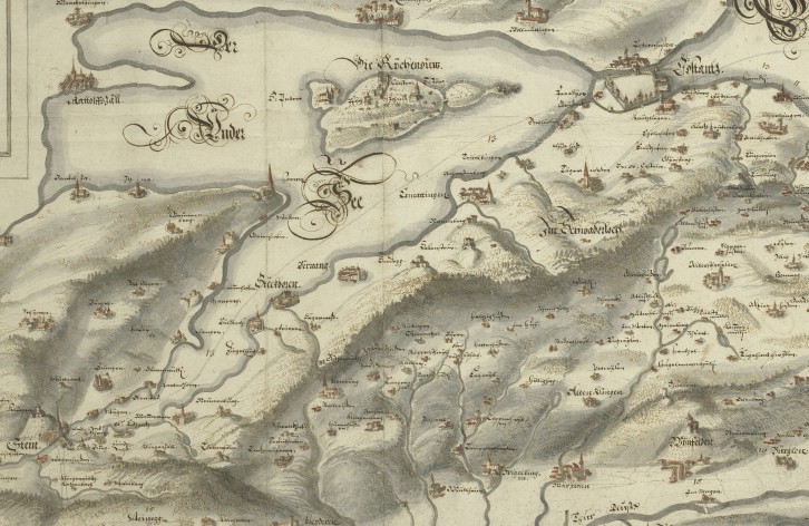
Map of Lake Constance and parts of Thurgau by Hans Conrad Gyger
The manuscript map of Lake Constance by Hans Conrad Gyger, dating from around 1630—an excerpt of which is shown here—covers the southern shore of the Untersee and Lake Constance from Diessenhofen and Stein am Rhein to the mouth of the Rhine near Altenrhein. Thurgau was a communal domain in which Reformed and Catholic bailiffs exercised high jurisdiction on a fixed rotation. Lower jurisdiction was exercised by a great many small judicial domains, which often comprised only a single village and belonged to ecclesiastical or secular lords. Ownership changed through inheritance or sale. Amid this tangle of jurisdictional rights, Zurich held three permanent estates with both high and low jurisdiction: in Pfyn, Wellenberg, and Weinfelden. The map, now preserved in the map collection of the Zurich Central Library, originates from Granhammer Castle in Sweden, where it was part of the Råland family library until 1960. Claes Råland, who later became a statesman, accompanied the Swedish king as a young officer during the Thirty Years’ War. In 1633, General Gustav Karlsson Horn violated Swiss neutrality with a Swedish army. He forced his way through the small town of Stein am Rhein—which at the time belonged to Zurich—crossed the Rhine on September 5, marched his army through the Thurgau region, and, from Swiss territory, laid siege to the city of Konstanz. On September 12, his troops plundered Romanshorn Castle. There were connections between individual citizens and even council members of the city of Zurich and the Protestant Swedes. The area from Schaffhausen to Diessenhofen and the southern parts of Thurgau are missing because they were not important to the Swedish war effort.
The map has the call number MK 801—the original is in the map collection of the Zurich Central Library.