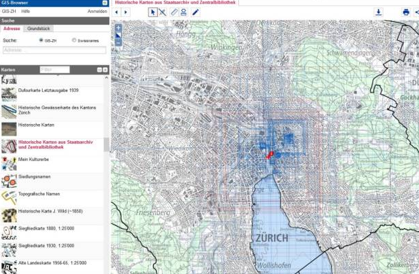
Holdings from the Zurich State Archives and Zurich Central Library in the cantonal GIS browser
16,000 historical maps from the Zurich State Archives and the Zurich Central Library can now be viewed in the GIS browser of the Canton of Zurich.
Thanks to participatory projects such as crowdsourcing and citizen science, dozens of volunteers were able to precisely geolocate the old maps in a very short time. In this process, prominent points on the historical maps were identified and assigned current coordinates. This allows them to be virtually overlaid on a modern world map and compared. Once the georeferencing was complete, the Office for Spatial Development integrated the old maps into the cantonal GIS Browser.
In the GIS browser, cartographic resources are displayed as colored boxes on the map. When a specific point is selected, the user sees, in the right-hand column, all maps in the GIS browser that include the selected location. Each map has three different links.
-
Link: detailed information about the map (scale, date, technique, etc.)
-
Link: takes you directly to the digitized version of the map, which can be zoomed in as desired
-
Link: leads to Old Maps Online; on this website, historical maps can be overlaid on modern world maps. The transparency can be adjusted using a slider. This allows the user to compare a historical situation with the present-day one.