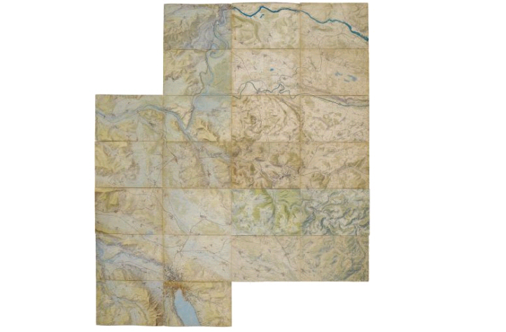
Andreas Hefti: War Game Map (1896) and Theater of War: South Africa (1900)
This spring, the Zurich Central Library was able to acquire the 24 sheets of Andreas Hefti’s “War Game Map” at auction from a private collector.
The famous “War Game Map” is a one-of-a-kind document that had never been published due to military secrecy. It depicts the northern and central parts of the canton of Zurich at a scale of 1:10,000. It was used by the Winterthur Officers’ Society during social evenings for tactical and strategic war-game simulations. Since existing printed maps at that scale were too small, Andreas Hefti was commissioned in the winter of 1893 to produce the individual relief maps as hand-drawn illustrations. The relief maps are based on the Siegfried Atlas map sheets, from which they were created through enlargement. This elaborate project was completed in 1896.
For further reading, see Arthur Dürst: The Zurich Maps by Andreas Hefti from 1895–96. Zurich 1998.
A few months ago, a map by Andreas Hefti that was previously unknown in the history of cartography also turned up in the holdings of the Zurich Map Collection (not mentioned in A. Dürst’s article on Andreas Hefti in the journal Cartographica Helvetica (1993)): “The Theater of War in South Africa 1899–1900” (with autograph!):