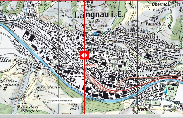
Why does Switzerland need new national maps?
Compare the old and new national maps
The 1:25,000-scale national map is being updated to reflect the latest technical and graphic standards.
The 1:25,000 national map, first published in the 1950s, no longer meets today’s requirements. It is based on the state of the art at that time and the topographic data available then. Requirements such as flexible data use across various media, efficient production processes, greater accuracy, and faster data updates can only be met through comprehensive modernization and by placing the national map on a new foundation.
In 2013, swisstopo began the comprehensive modernization of Switzerland’s largest official map series—the 1:25,000 National Map, comprising 247 sheets.
This restructuring also involves adjustments to the cartographic representation. Readability is being improved through numerous measures developed in a broad-based process in collaboration with users. For example, a new typeface is being used, and features such as railroads are easier to read thanks to color differentiation. These improvements are evident both in the printed maps and when using them in digital media.
Following the publication of the first eight sheets of the new 1:25,000 national map in the spring of 2014, four additional sheets have since been released for the Emmental and Entlebuch regions.
The replacement of the old 1:25,000 national map is taking place simultaneously with the update and is scheduled to be completed in 2019. In the long term, the national maps at all scales will be updated.
Fig.: “New National Maps for Switzerland,” Federal Office of Topography swisstopo, interactive map