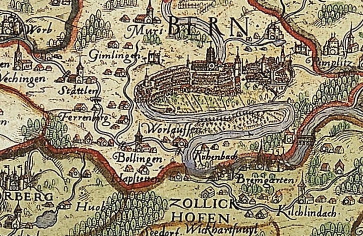
Map of the Bernese territory by Thomas Schoepf, 1578
The great achievement of the city physician Thomas Schoepf in 1578—the publication of the first large-scale map of the Bernese territory at a scale between approximately 1:85,000 and 1:115,000, remained unmatched throughout the 17th century. Less well known are the surviving manuscripts, the one housed in the Berner Bürgerbibliothek having now been translated from Latin into German. In issue 47 of the journal Cartographica Helvetica, Prof. Martin Korenjak announced a translation, which has since been carried out by Ms. Theresa Rothfuss and is available online. Thanks to this translation, further research into the content of the Schoepf map is now easier to conduct.
The map was likely supported by the Bernese authorities, but it was not commissioned by them. Of the many arguments Thomas Schoepf used in his handwritten commentary to justify the publication of his map, only a few will be briefly highlighted here:
Thomas Schoepf, whose primary occupation as a city physician was dealing with people’s illnesses and pain, wanted to create something useful for everyday life. He took pleasure in this sideline, which he pursued in his spare time, and sought to convey this joy to the viewer of the map: The useful and the pleasant were to be combined.
Schoepf assumed that the map would show all the devout people of the world the greatness of Bern, a state that provided protection to the Church and asylum to many persecuted people. These devout people would therefore include the state in their prayers and thus ensure its longevity. He believed the map was also useful for state administration: the authorities govern best when they know their territory and the living conditions of their subjects. With the term “tabula arctographica” (map depicting bears), Schoepf also established a connection in his commentary to the symbol of Bernese statehood.
Since the map served as the basis—or primary map—for many subsequent maps, Thomas Schoepf’s masterpiece shaped Bernese cartography for a long time. Copying or compiling printed maps was common practice at the time.
In 1638, for example, Joseph Plepp, as a cartographer, published a significantly reduced and simplified edition of Schoepf’s map, while retaining the map’s southern orientation. The scale varies between approximately 1:300,000 and 1:400,000. As a painter, surveyor, and architect, Plepp possessed the skills and necessary understanding for the challenging task of reducing Schoepf’s wall map—comprising 18 copper plates—to the standard map format.
Fig.: Detail from the wall map of the Bernese territory by Thomas Schoepf, 1578, sheet 9/10, copperplate engraving, Map online